The mapping of the Netherlands East Indies was, first and foremost, meant to serve as an instrument for the government to keep its inhabitants under control and tap its resources. Only after 1900, in studies to alleviate poverty, did the colonial su...Loe edasi...
Dynamic Point Symbols in Earthquake Mapping: Visualization Research in Space and Time examines how animated symbols enhance digital map comprehension, particularly for earthquake data visualization. It provides much-needed empirical evidenc...Loe edasi...
(Ilmumisaeg: 19-Mar-2026, Hardback, Kirjastus: The History Press Ltd, ISBN-13: 9781837051120)
A new study, for first time revealing the story of Greenvile Collins, hugely significant historical character, cartographer to the King, and author of Great Britains Coasting Pilot, the foundation stone of British hydrography...Loe edasi...
Modern Web Cartography is your ultimate guide to practical web maps using open source tools, with a particular focus on OpenStreetMap (OSM) and its rich ecosystem. In an era where maps are embedded in virtually every digital service from navigation...Loe edasi...
Explore new places with handy pocket maps from Collins. Handy full-color map of Ireland’s Wild Atlantic Way with a high level of detail. Clear mapping of the full 2500 km (over 1500 miles) route, showing the road network and places of interest. ...Loe edasi...
This open-access SpringerBrief accompanies and explains a comprehensive GIS dataset that traces both the external and internal administrative borders of the current 27 EU member states, the United Kingdom, the EFTA member states (Iceland, Liechtenst...Loe edasi...
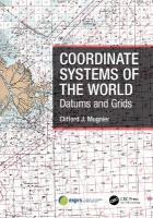
A comprehensive consolidation of data for the world, this book gives a short precis of each nation, each nation’s history, its topography and a chronology of the development of geodetic surveying and coordinate systems for that specific nation. A...Loe edasi...
(Ilmumisaeg: 22-Jan-2026, Hardback, Kirjastus: Cambridge University Press, ISBN-13: 9781009636032)
This essential history tells the fascinating story of encounters between Chinese and Western traditions of world geography and cartography. It reveals how cross-cultural exchanges shaped our understanding of the world, enriches global perspectives a...Loe edasi...
Mapping has evolved beyond navigation into a method for interpreting spatial, ephemeral, and sociopolitical dimensions of contemporary life. This volume explores how cartographic practices are being reimagined across disciplines to understand and...Loe edasi...
This book uniquely bridges the conceptual gap between the history of geographic, cartographic thought and film theory with the technological and cultural shifts that shaped the emergence of cameras and cinema. This book uniquely bri...Loe edasi...
Location Awareness in the Age of Google Maps explores the mundane act of navigating cities in the age of digital mapping infrastructures. Location Awareness in the Age of Google Maps explores the mundane act of navi...Loe edasi...
New title in the Flame Tree Blank Notebook collection, combining beautiful art with high-quality production, and featuring blank pages, a pocket at the back and two ribbon bookmarks. Perfect slipped into handbags, for personal use or as a dazzling...Loe edasi...
(Ilmumisaeg: 14-Nov-2025, Hardback, Kirjastus: Springer International Publishing AG, ISBN-13: 9783031970580)
This book explores a simple but powerful idea. The way we organize the ground of our cities impacts everyday life. In other words, the street systems, plot patterns and building arrangements we lay down on the ground influence, first, the main thr...Loe edasi...
As we must know, the hijab has been historically considered in Euro-America a symbol of difference between east and west. The hijab was also mostly seen and described as awful regarding gender, politics, visuality, and the conception of self. Even F...Loe edasi...
Professor Dr Fuat Sezgin meticulously documented the scientific writings and advances achieved by Muslim scholars. His celebrated Geschichte des arabischen Schrifttums (GAS), the largest bio-bibliography for the Arabic literary tradition in ge...Loe edasi...
Modelling the City focuses on European towns and cities, analysing the opportunities and limitations of modelling of urban space.This book examines how urban space from the past is discovered, explained and presented. It discusses th...Loe edasi...
Every map tells a story and this book tells the incredible history of our world through maps. Every map tells a story—and this book tells the incredible history of our world through maps. From Babylonian clay ta...Loe edasi...
This magnificent book highlights a vast selection of maps that range across the centuries and cover every part of the island, shedding light on the history and development of Ireland. Featuring over stunning 200 map and map extracts, this book will a...Loe edasi...
A new edition of this fascinating and unusual journey through the world of maps and mapmakers, drawing on 700 years worth of maps from the National Archives. A new edition of this fascinating and unusual journey through the world of ma...Loe edasi...
The greatest F1 cars from 1950 to the present dayA stunning Formula One book with amazing photography showcasing 50 iconic F1 cars across every era to the modern day, highlighting engineering innovations, impact on the automotive industry, historic r...Loe edasi...
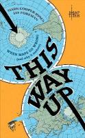
A sparkling exploration of direction, by the acclaimed author of A History of the World in 12 Maps North, south, east and west: almost all societies use the four cardinal directions to orientate themselves, to understand who they are by p...Loe edasi...
The mapping of the Netherlands East Indies was, first and foremost, meant to serve as an instrument for the government to keep its inhabitants under control and tap its resources. Only after 1900, in studies to alleviate poverty, did the colonial su...Loe edasi...
Dynamic Point Symbols in Earthquake Mapping: Visualization Research in Space and Time examines how animated symbols enhance digital map comprehension, particularly for earthquake data visualization. It provides much-needed empirical evidenc...Loe edasi...
In Mapping the Mountains, author, geographer, and map enthusiast (and Dutch Mountain Film Festival team member) Andrew Davies recounts the most delicious of these adventures from the history of mountain cartography, richly illustrated with the relev...Loe edasi...
(Ilmumisaeg: 19-Mar-2026, Hardback, Kirjastus: The History Press Ltd, ISBN-13: 9781837051120)
A new study, for first time revealing the story of Greenvile Collins, hugely significant historical character, cartographer to the King, and author of Great Britains Coasting Pilot, the foundation stone of British hydrography...Loe edasi...
Sari: Studies in Early American Economy and Society from the Library Company of Philadelphia
(Ilmumisaeg: 17-Mar-2026, Hardback, Kirjastus: University of Pennsylvania Press, ISBN-13: 9781512829259)
Explores how and why people manipulated borders in the early modern Atlantic worldClaiming Land, Claiming Water shares what historians and geographers wish readers knew about maps and borders before, during, and after the fou...Loe edasi...
When the New World was really new, Theodore de Bry drew inspiration from history’s great explorers to record its wonders. From Virginia and Florida to Brazil, his engravings captivated the European imagination with freshly discovered landscapes, cust...Loe edasi...
Cartographies of Catastrophes is an in-depth exploration of how disasters, whether due to wars or to natural calamities, have been documented and mapped over the past two centuries. This interdisciplinary volume brings together historians,...Loe edasi...
Modern Web Cartography is your ultimate guide to practical web maps using open source tools, with a particular focus on OpenStreetMap (OSM) and its rich ecosystem. In an era where maps are embedded in virtually every digital service from navigation...Loe edasi...
Explore new places with handy pocket maps from Collins. Handy full-color map of Ireland’s Wild Atlantic Way with a high level of detail. Clear mapping of the full 2500 km (over 1500 miles) route, showing the road network and places of interest. ...Loe edasi...
This open-access SpringerBrief accompanies and explains a comprehensive GIS dataset that traces both the external and internal administrative borders of the current 27 EU member states, the United Kingdom, the EFTA member states (Iceland, Liechtenst...Loe edasi...
A comprehensive consolidation of data for the world, this book gives a short precis of each nation, each nation’s history, its topography and a chronology of the development of geodetic surveying and coordinate systems for that specific nation. A...Loe edasi...
Explores the captivating mechanics behind transforming Earths surface into an accurate flat representation. Unravels the mathematical ideas of map distortion through diagrams, multivariable calculus, and complex variables while following a rich his...Loe edasi...