Muutke küpsiste eelistusi

E-raamat: History of the World in Twelve Maps

3.76/5 (1976 hinnangut Goodreads-ist)
  • Formaat: EPUB+DRM
  • Ilmumisaeg: 06-Sep-2012
  • Kirjastus: Penguin Books Ltd
  • Keel: eng
  • ISBN-13: 9781846145704
  • Formaat - EPUB+DRM
  • Hind: 9,49 €*
  • * hind on lõplik, st. muud allahindlused enam ei rakendu
  • Lisa ostukorvi
  • Lisa soovinimekirja
  • See e-raamat on mõeldud ainult isiklikuks kasutamiseks. E-raamatuid ei saa tagastada.
  • Formaat: EPUB+DRM
  • Ilmumisaeg: 06-Sep-2012
  • Kirjastus: Penguin Books Ltd
  • Keel: eng
  • ISBN-13: 9781846145704

DRM piirangud

  • Kopeerimine (copy/paste):

    ei ole lubatud

  • Printimine:

    ei ole lubatud

  • Kasutamine:

    Digitaalõiguste kaitse (DRM)
    Kirjastus on väljastanud selle e-raamatu krüpteeritud kujul, mis tähendab, et selle lugemiseks peate installeerima spetsiaalse tarkvara. Samuti peate looma endale  Adobe ID Rohkem infot siin. E-raamatut saab lugeda 1 kasutaja ning alla laadida kuni 6'de seadmesse (kõik autoriseeritud sama Adobe ID-ga).

    Vajalik tarkvara
    Mobiilsetes seadmetes (telefon või tahvelarvuti) lugemiseks peate installeerima selle tasuta rakenduse: PocketBook Reader (iOS / Android)

    PC või Mac seadmes lugemiseks peate installima Adobe Digital Editionsi (Seeon tasuta rakendus spetsiaalselt e-raamatute lugemiseks. Seda ei tohi segamini ajada Adober Reader'iga, mis tõenäoliselt on juba teie arvutisse installeeritud )

    Seda e-raamatut ei saa lugeda Amazon Kindle's. 

'Fascinating, panoramic, wonderful' Tom Holland

A magical book which explores how the world was seen at twelve points in history, through twelve extraordinary maps and the minds of those who made them

What you see depends on where - and when - you are looking from. As Jerry Brotton's enthralling book shows, maps have shaped our view of the world throughout history, and are themselves shaped by the ideas, prejudices, systems of power and creativity of their age.

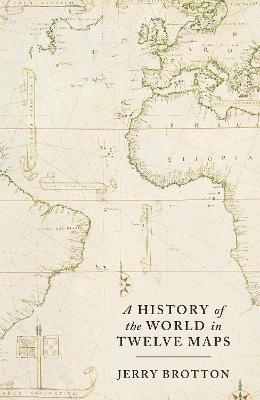
Brotton examines twelve world maps from global history - from the mystical representations of ancient civilizations and the fourteenth-century Mappamundi to the satellite-derived imagery of today - to show how, by reading them, we can better understand the worlds that produced them. You will not look at a map in quite the same way again.

'The intellectual background to these images is conveyed with beguiling erudition ... maps prove to be less conveyors of information than theatrical performances ... There is nothing more subversive than a map' Andrew Linklater, Spectator

'Fascinating and thought-provoking ... An achievement of evocation' Anthony Sattin, Literary Review

'Elegant, powerfully argued' David Horspool, Guardian, Books of the Year

'Rich and adventurous' John Carey, Sunday Times

'A highly rewarding study ... you will emerge with a detailed insight into how maps reflect, expose and manipulate the societies in which they are made' Simon Garfield, Mail on Sunday

Arvustused

[ A] fascinating and panoramic new history of the cartographer's art... Brotton's idea of tracing within maps the patterns of human thought is a wonderful one -- Tom Holland * Guardian * As this mesmerising and beautifully illustrated book demonstrates, maps have, since ancient times, carried vast symbolic weight ... rich and endlessly absorbing history -- Sinclair McKay * Daily Telegraph * An elegant, powerfully argued variation on the theme of knowledge as power and ignorance as powerlessness -- David Horspool * Guardian * Rich and adventurous -- John Carey * Sunday Times * An achievement of evocation....a fascinating and thought-provoking book -- Anthony Sattin * Literary Review * Brotton is acutely sensitive to the social, political and religious contexts which unravel why maps were made, for whom and with what axes to grind -- Robert Mayhew * History Today * A highly rewarding study -- Simon Garfield * Mail on Sunday * Engrossing reading -- Carl Wilkinson * Financial Times * The intellectual background to these images is conveyed with beguiling erudition ... There is nothing more subversive than a map -- Andrew Linklater * Spectator * It is a wonderful history, which will delight anyone with an interest in history and geography -- David Wooton * TLS *

List of Figures
ix
List of Illustrations
xiii
Introduction 1(16)
1 Science: Ptolemy's Geography, c. AD 150
17(37)
2 Exchange: Al-Idrisi, AD 1154
54(28)
3 Faith: Hereford Mappamundi, c. 1300
82(32)
4 Empire: Kangnido World Map, 1402
114(32)
5 Discovery: Martin Waldseemuller, World Map, 1507
146(40)
6 Globalism: Diogo Ribeiro, World Map, 1529
186(32)
7 Toleration: Gerard Mercator, World Map, 1569
218(42)
8 Money: Joan Blaeu, Atlas maior, 1662
260(34)
9 Nation: The Cassini Family, Map of France, 1793
294(43)
10 Geopolitics: Halford Mackinder, `The Geographical Pivot of History', 1904
337(36)
11 Equality: The Peters Projection, 1973
373(32)
12 Information: Google Earth, 2012
405(32)
Conclusion: The Eye of History? 437(10)
Notes 447(36)
Acknowledgements 483(4)
Index 487
Jerry Brotton is Professor of Renaissance Studies at Queen Mary University of London, and a leading expert in the history of maps and Renaissance cartography. His most recent book, The Sale of the Late King's Goods: Charles I and his Art Collection (2006), was short-listed for the Samuel Johnson Prize as well as the Hessell-Tiltman History Prize. In 2010, he was the presenter of the BBC4 series 'Maps: Power, Plunder and Possession'.