Muutke küpsiste eelistusi

E-raamat: Isle of Skye: Walks and scrambles throughout Skye, including the Cuillin

  • Formaat: 288 pages
  • Ilmumisaeg: 10-Jul-2024
  • Kirjastus: Cicerone Press
  • Keel: eng
  • ISBN-13: 9781783621354
Teised raamatud teemal:
  • Formaat - EPUB+DRM
  • Hind: 28,20 €*
  • * hind on lõplik, st. muud allahindlused enam ei rakendu
  • Lisa ostukorvi
  • Lisa soovinimekirja
  • See e-raamat on mõeldud ainult isiklikuks kasutamiseks. E-raamatuid ei saa tagastada.
  • Formaat: 288 pages
  • Ilmumisaeg: 10-Jul-2024
  • Kirjastus: Cicerone Press
  • Keel: eng
  • ISBN-13: 9781783621354
Teised raamatud teemal:

DRM piirangud

  • Kopeerimine (copy/paste):

    ei ole lubatud

  • Printimine:

    ei ole lubatud

  • Kasutamine:

    Digitaalõiguste kaitse (DRM)
    Kirjastus on väljastanud selle e-raamatu krüpteeritud kujul, mis tähendab, et selle lugemiseks peate installeerima spetsiaalse tarkvara. Samuti peate looma endale  Adobe ID Rohkem infot siin. E-raamatut saab lugeda 1 kasutaja ning alla laadida kuni 6'de seadmesse (kõik autoriseeritud sama Adobe ID-ga).

    Vajalik tarkvara
    Mobiilsetes seadmetes (telefon või tahvelarvuti) lugemiseks peate installeerima selle tasuta rakenduse: PocketBook Reader (iOS / Android)

    PC või Mac seadmes lugemiseks peate installima Adobe Digital Editionsi (Seeon tasuta rakendus spetsiaalselt e-raamatute lugemiseks. Seda ei tohi segamini ajada Adober Reader'iga, mis tõenäoliselt on juba teie arvutisse installeeritud )

    Seda e-raamatut ei saa lugeda Amazon Kindle's. 

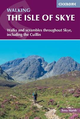
Guidebook with 87 walks and scrambles on the Isle of Skye. Walks visit the most awe-inspiring scenery on Skye, including Sleat and South-East Skye, Strath, Minginish, Duirinish, Waternish, Trotternish and the Cuillin. Walks range from coastal walks to Munros with exposure for experienced scramblers. Includes history, geology and local information.

This guidebook describes 87 of the best walks and scrambles on the Isle of Skye. Not only limited to the popular routes on the Black Cuillin or Skye's 12 Munros, the guide offers a comprehensive selection of routes in all areas of the island; in Sleat and South-East Skye, Strath, Minginish, Duirinish, Waternish and Trotternish. The routes range in length from 2 to 23km, so while there are opportunities for novice walkers, routes can also be combined for longer trails and difficult scrambles. Skye can delight walkers and scramblers at every turn, from sea stacks to fell tops; corries to rugged cliffs and plenty in between. Walkers on Skye should be prepared for strenuous trails and wilderness, as well as changeable weather, navigation, and - depending on the route - scrambling skills. However, the routes in this guide range in length from 2 to 23km, so while there are opportunities for novice walkers, routes can also be combined for longer trails and difficult scrambles.Alongside detailed descriptions and OS maps for every route, the guidebook also includes practical information essential to making the most out of a visit to Skye. From travel to and around the island, to advice on accommodation, where to stock up on supplies and who to call in emergencies. The result is an excellent companion to exploring the best of Skye.

This guidebook describes 87 walks and scrambles on the Isle of Skye, visiting the island's most awe-inspiring scenery including Sleat and South-East Skye, Strath, Minginish, Duirinish, Waternish, Trotternish and the Cuillin.

The routes explore many different landscapes on the island, ranging from coastal walks, lonely lochans, coastal cliffs and forests to Munros and mountain traverses, with exposure for experienced scramblers. There are hard, demanding days as tough as anything in the British Isles and the walks are in wonderfully isolated situations. The guide includes notes on history and geology as well as all useful local information.

The Isle of Skye is a place of elemental forces, a land that man has barely scratched.

Acknowledgements
Preface

Introduction

History
Geology
Flora and Fauna
How to get there
Facilities and accommodation
Using this guide
Access
Safety
Maps
Paths
Language

The Walks

1 SLEAT AND SOUTH-EAST SKYE

1.1 Gleann Meadhonach, Loch a'Ghlinne and Dalavil
1.2 Acairseid an Rubha and Point of Sleat
1.3 Armadale
1.4 Sgurr na Coinnich
1.5 Beinn na Caillich
1.6 Ben Aslak
1.7 Kylerhea Glen Circuit
1.8 Coastal Path from Loch na Dal to Kylerhea
1.9 Kylerhea Trail

2 STRATH

Broadford

2.1 Broadford Coast Path (Irishman's Point)

North of Strath Suardal

2.2 Coire Gorm Horseshoe
2.3 Beinn na Cro
2.4 Srath Mór and Srath Beag

South of Strath Suardal

2.5 Suisnish and Boreraig

Cuillin Outliers

2.6 Bla Bheinn
2.7 Sgurr nan Each
2.8 Garbh-bheinn
2.9 Belig
2.10 Glas Bheinn Mhór
2.11 South Ainort Circular


The Red Hills

2.12 Marsco
2.13 The Beinn Deargs
2.14 Glamaig
2.15 Glen Sligachan


Strathaird Peninsula

2.16 Kilmarie to Camasunary
2.17 Camasunary to Elgol
2.18 Suidhe Biorach (Prince Charles' Cave)
2.19 Rubha na h-Easgainne
2.20 Spar Cave

3 MINGINISH

The Cuillin

3.1 Sgurr nan Gillean
3.2 Sgurr Beag and Sgurr na h-Uamha
3.3 Coire a'Bhasteir Am Basteir
3.4 Sgurr a'Bhasteir
3.5 Fionn Choire, Bealach nan Lice and Sgurr a'Fionn Choire
3.6 Bruach na Frithe
3.7 Coire na Creiche
3.8 Coire a'Ghreadaidh
3.9 Sgurr Thuilm, Sgurr a'Mhadaidh and Sgurr a'Ghreadaidh
3.10 Sgurr na Banachdich and Sgurr nan Gobhar
3.11 Eas Mor and Coire na Banachdich
3.12 Sgurr Dearg and Inaccessible Pinnacle
3.13 Coire Lagan
3.14 Sgurr Alasdair
3.15 Coir' a'Ghrunnda and Loch Coir' a'Ghrunnda
3.16The South Cuillin ridge
3.17 Loch an Fhir-bhallaich
3.18 Rubh' an Dùnain

Glen Sligachan

3.19 Harta and Lota Corries
3.20 Druim Hain and Sgurr na Stri
3.21 Loch Coruisk

Loch Brittle to Loch Bracadale

3.22 Glen Brittle Forest Walk
3.23 Talisker Bay
3.24 Oronsay

4 DUIRINISH

4.1 Loch Bharcasaig, Idrigill Point and MacLeod's Maidens
4.2 Glen Ollisdal and MacLeod's Maidens
4.3 Duirinish Coastal Path
4.4 Healabhal Bheag (MacLeod's Table South)
4.5 Healabhal Mhor (MacLeod's Table North)
4.6 Lorgill Bay
4.7 Lorgill, The Hoe and Ramasaig Bay
4.8 Waterstein Head
4.9 Neist Point
4.10 Uiginish Point
4.11 The Coral Beaches
4.12 Lovaig Bay

5 WATERNISH

5.1 Ardmore Point
5.2 Unish and Waternish Point
5.3 Beinn an Sguirr
5.4 Loch Diubaig and Greshornish Point

6 TROTTERNISH AND PORTREE

Trotternish

6.1 Meall Tuath and Rubha Hunish
6.2 Loch Sneosdal and Creag Sneosdal
6.3 Loch Hasco
6.4 The Quiraing and Meall na Suiramach
6.5 Meall na Suiramach
6.6 The Old Man of Storr
6.7 The Storr
6.8 The Trotternish Ridge
6.9 Biode Buidhe
6.10 Beinn Edra
6.11 Ruadh nam Brathairean (Brothers' Point)
6.12 Loch Cuithir, Sgurr a'Mhadaidh Ruaidh and Baca Ruadh
6.13 Inver Tote and the Lealt waterfall
6.14 Bearreraig Bay
6.15 Sithean Bhealaich Chumhaing

Portree

6.16 Glen Varrigill Forest Walk
6.17 Ben Tianavaig
6.18 The Braes

APPENDIX 1 Essential and supplementary reading
APPENDIX 2 Glossary of Gaelic words
APPENDIX 3 Useful information and contact details

INDEX
Dr Terry Marsh is a Lancashire-based award-winning writer and photographer who specialises in the outdoors, the countryside, walking and travel worldwide. He has been writing books since the mid-1980s, and is the author of over 100 titles.